
Deutschlands einzige Hochseeinsel – so präsentiert sich das gerade mal 1 km² kleine Eiland mit seinen etwa 1300 Einwohnern. Ich lade sie ein „Deät Lun“ in einem kleinen Rundgang zu entdecken.
„Deät Lun“, „Das Land“, so nennen die Helgoländer ihre Insel. Helgoland, dessen Hauptinsel zusammen mit der benachbarten [post=“144″ text=“Strandinsel Düne“] eine Gemeinde im Kreis Pinneberg im Bundesland Schleswig-Holstein bildet, stellt innerhalb der Deutschen Bucht die nordwestliche Begrenzung der Helgoländer Bucht dar. Beide Inseln liegen im Naturschutzgebiet Helgoländer Felssockel.
Die Insel gliedert sich in Oberland, Mittelland und Unterland. Im Süden, neben der Landungsbrücke, besitzt der rote Felsen einen kleinen Sandbadestrand. Der Meeresgrund fällt im südwestlich gelegenen Helgoländer Becken bis 56 m unter NN ab.

Die Insel
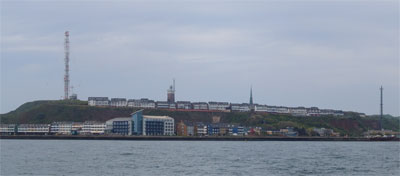
Die Ansicht entstand bei der Überfahrt von Helgoland auf die [post=“144″ text=“Düne“]. Deutlich sind die Häuser und Hotels im Unter- und Oberland zu sehen. Ebenso prominent sticht der hohe Sendemast der Telekom hervor. Dagegen wirken der Leucht- und der Kirchturm recht klein. Links von der Insel liegen zwei Bäderschiffe auf Reede.
Der Pinneberg
Mit 61,3 m ist der Pinneberg die höchste Erhebung der Insel. Er befindet sich im Oberland und ist nur über einen Trampelpfad zu erreichen. Auf seinem „Gipfel“ ist ein eisernes Gipfelkreuz aufgestellt. Der Pinneberg ist zugleich auch die höchste Erhebung des Kreises Pinneberg. Wer möchte kann sich dort auch in ein Gipfelbuch eintragen.
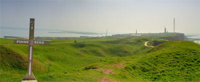
Oberland im Westen
Das Oberland fällt im Norden, Westen und Südwesten in steilen Klippen gut 50 Meter zum Meer hin ab. Rund um das Oberland führt ein schöner, etwa 5 km langer Klippenrundweg.
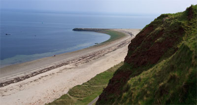
Helgolands Nordstrand
Der Strand im Norden ist wegen der sehr starken Strömung nicht zum Baden geeignet. Am Nordwestende der Hauptinsel befindet sich auch das bekannteste Wahrzeichen Helgolands: Die Lange Anna.
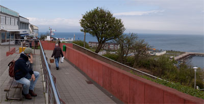
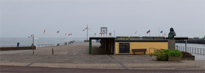
Helgoland der Ort
Die „Halunder“ leben im Unter- und am südöstlichen Ende des Oberlandes. Ein Aufzug und eine Treppe verbindet das Ober- mit dem Unterland. An der Promenade hat man einen schönen Blick auf die Hafenanlage und die [post=“144″ text=“Düne“].
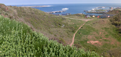
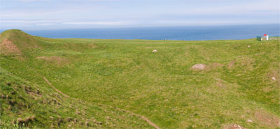
Mittelland
Das Mittelland ist erst durch die große Sprengung der Alliierten am 18. April 1947 entstanden. An diesem Tag erschütterten 6700 Tonnen Munition die Insel mit ihrem Sockel bis in eine Tiefe von mehreren Kilometern und führten zu einer nachhaltigen Veränderung ihres Aussehens.
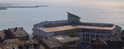
Unterland
Im Unterland befinden sich neben dem Rathaus und Hotels einige Geschäfte, welche vor allem auf das Geschäft mit zollfreien Waren für Tagesbesucher eingerichtet sind. Daneben sind auch die bekannten Hummerbuden mit ihren bunten Farben und der markante Turm der Meeresbiologischen Anstalt zu sehen.
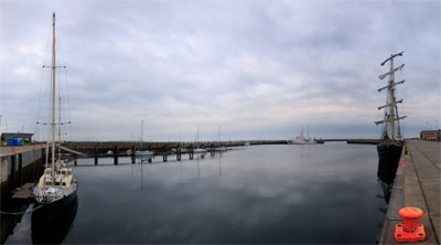
Südhafen
Während die Seebäderschiffe vor der Insel auf Reede liegen, können kleinere, beziehungsweise Schiffe mit geringem Tiefgang direkt in den Südhafen einlaufen. Hier legt auch täglich der Katamaran Halunder Jet an. Nachdem die letzten Schiffe den Rückweg zum Festland angetreten haben, wird es aber auch hier sehr ruhig.
Landungsbrücken
Direkt an der Kurpromenade befinden sich die Landungsbrücken. Hier legen die Bördeboote an und meist ist hier der Anlegeplatz der Fähre zur Düne.